Kailash Mansarovar yAtra - Nepal Route
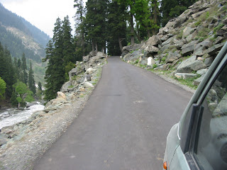
During the 14-day long trip from Kathmandu to Kailash and back, we (a group of 18 women, ranging in age from 21 to 60) crossed magnificent mountains, sacred lakes, deep gorges, virgin waterfalls and lush green canyons. We climbed to over 18500 ft height. This trek is one of the more difficult in Asia and physically challenging due to dry, cold Tibetan terrain and difficulties faced at high altitude. Many of us felt unwell often.
There were many uncertainties on the way – Our chinese guide didn’t reach border on time, sudden landslides or boulders on the roads, the tyres of the bus got mired on the banks of Brahmaputra. Neither horses nor porters were available during the days of the parikrama.
Accommodation and food are very basic, one is far away from (conventional notions of) civilization. At every step many wished to abandon the trip and return home, yet decide to keep going, determined to complete the trek solely because of team mates, accompanying Sherpas and the sight of other yAtris.
The Nepal route to Kailash-Mansarovar (10 days)


Kathmandu-Kodari-(Friendship Bridge)-Zhang Mu (altitude 2225 m) (border town of Tibet) - Nyalam (altitude 3750 m) - Zhongba (Dongba / Drongba) (altitude 4610m) - Tong-La (Pass at altitude 5200 m) - Lake Peiku-Tso - Saga (4600 m) - Mansarovar Lake (4590 m, perimeter 88 km).
 The circumambulation of the lake is done by vehicle, and the waypoints are the camps Hor Quo and Chui Gompa.
We glimpse Rakshas Tal, the forbidden lake adjacent to Mansarovar. Beyond the holy lake lies Darchen (4663 m), the base camp for Mt Kailash. The parikrama of the holy abode involves trekking about 40 km commencing at the Yama Dwar. Part of this distance can be covered on horseback, and the trek is usually completed in 3 days. The two waypoints for night halt are Deraphuk (altitude 4880m) and Zutulphuk (altitude 4760m). On the second day of the Mt Kailash parikrama, we reach Dolma La, altitude 5670 m.
Kathmandu to Kodari 123 km
Kodari to Zhangmu to Nyalam 33 km
Nyalam to Saga 250 km
Saga to Mansarovar 450 km
Lake Mansarovar Parikrama 72 km
Lake Mansarovar to Darchen 53 km
Darchen to Yama Dwar and Tarboche 8km (45 minutes drive)
Tarboche (starting point for Mt Kailash parikrama) to Deraphuk Gompa 10 km (Day 6, 5 hours walk / horseback)
Deraphuk Gompa to Zutulphuk Gompa: 22 km (Day 7, 10 hours consisting of a 4 hour climb, 2 hour descent on foot and 4-5 hours walk / horseback near-flat terrain)
Zutulphuk to Darchen pick up point 6 km (Day 8, 3 hours, near-flat terrain)
 The return journey commences by vehicle from Darchen, to reach Kodari after a couple of night halts.
Note: You are likely to find some of the place names only in tour logs, not on online maps.
There were many uncertainties on the way – Our chinese guide didn’t reach border on time, sudden landslides or boulders on the roads, the tyres of the bus got mired on the banks of Brahmaputra. Neither horses nor porters were available during the days of the parikrama.
Accommodation and food are very basic, one is far away from (conventional notions of) civilization. At every step many wished to abandon the trip and return home, yet decide to keep going, determined to complete the trek solely because of team mates, accompanying Sherpas and the sight of other yAtris.
The Nepal route to Kailash-Mansarovar (10 days)


Kathmandu-Kodari-(Friendship Bridge)-Zhang Mu (altitude 2225 m) (border town of Tibet) - Nyalam (altitude 3750 m) - Zhongba (Dongba / Drongba) (altitude 4610m) - Tong-La (Pass at altitude 5200 m) - Lake Peiku-Tso - Saga (4600 m) - Mansarovar Lake (4590 m, perimeter 88 km).

We glimpse Rakshas Tal, the forbidden lake adjacent to Mansarovar. Beyond the holy lake lies Darchen (4663 m), the base camp for Mt Kailash. The parikrama of the holy abode involves trekking about 40 km commencing at the Yama Dwar. Part of this distance can be covered on horseback, and the trek is usually completed in 3 days. The two waypoints for night halt are Deraphuk (altitude 4880m) and Zutulphuk (altitude 4760m). On the second day of the Mt Kailash parikrama, we reach Dolma La, altitude 5670 m.

Kathmandu to Kodari 123 km
Kodari to Zhangmu to Nyalam 33 km
Nyalam to Saga 250 km
Saga to Mansarovar 450 km
Lake Mansarovar Parikrama 72 km
Lake Mansarovar to Darchen 53 km
Darchen to Yama Dwar and Tarboche 8km (45 minutes drive)
Tarboche (starting point for Mt Kailash parikrama) to Deraphuk Gompa 10 km (Day 6, 5 hours walk / horseback)
Deraphuk Gompa to Zutulphuk Gompa: 22 km (Day 7, 10 hours consisting of a 4 hour climb, 2 hour descent on foot and 4-5 hours walk / horseback near-flat terrain)
Zutulphuk to Darchen pick up point 6 km (Day 8, 3 hours, near-flat terrain)


Note: You are likely to find some of the place names only in tour logs, not on online maps.
I thoroughly enjoy to read it. Thanks for sharing it.I need such type of post that enhance my knowledge.Keep posting.
ReplyDeleteThanks,
Mount Kailash | Kailash Mansarovar 2012 | Kailash Mansarovar Tour | Kailash Yatra
your blog is very nice abhou Kailash Mansarovar yatra
ReplyDelete